Super Typhoon 'Rosal' Enters Philippine Area of Responsibility — Signal No. 1 Raised for Northern Luzon and Other Areas
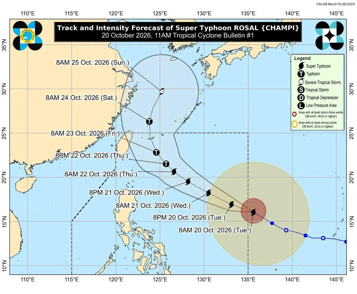
📌 At 10:40 a.m. on Tuesday, October 20, Super Typhoon 'Champi' entered the Philippine Area of Responsibility (PAR) and will be called 'Rosal.' The Philippine Atmospheric, Geophysical and Astronomical Services Administration (PAGASA) has raised Tropical Cyclone Wind Signal No. 1 for Batanes and parts of Cagayan, Isabela, and Catanduanes, and expects the typhoon to exit the PAR on the evening of Friday the 23rd or early Saturday the 24th.
■ What's Changing
· As of 10 a.m. on the 20th, the center was about 1,385 km east of central Luzon at sea, with maximum sustained winds of 185 km/h near the center and gusts up to 230 km/h. It was moving west-northwest at 25 km/h.
· Signal No. 1 areas: Batanes, the eastern Babuyan Islands (Babuyan, Camiguin, Didicas Island), eastern mainland Cagayan (Santa Ana, Gonzaga, Aparri, etc.), northeastern Isabela (Palanan, Ilagan City, etc.), and northeastern Catanduanes (Pandan, Bagamanoc, etc.). Wind damage is expected to be minor at this stage.
· PAGASA said the signal could expand to more areas and that some areas could be raised to Signal No. 2 or No. 3.
· The typhoon is forecast to move west-northwest until Wednesday the 21st, then north-northwest until Friday morning the 23rd, before turning north. It could strengthen over the Philippine Sea and is expected to weaken to typhoon strength on Thursday the 22nd.
· According to The Manila Times, as of 4 p.m. on the 20th, the center was about 1,270 km east of central Luzon, with maximum winds of 195 km/h (gusts of 240 km/h). PAGASA said there would be no landfall but that its wide radius would graze coastal areas on the 22nd and 23rd. It issued strong wind warnings for waves of 2.8–4.5 m along the eastern coasts of Catanduanes, Batanes, the Babuyan Islands, Cagayan, and eastern Isabela, advising small vessels to remain in port.
■ Tips for Residents and Travelers
· As of the 20th's announcement, central Luzon (including Angeles and Clark) and Metro Manila are not under any signal, but signal areas could expand, so check PAGASA's latest bulletins.
· If you plan to travel to Batanes, Cagayan, Isabela, or Catanduanes, or to take a ferry, check with airlines and shipping companies in advance about domestic flight and ferry cancellations for the 22nd–24th.
■ Sources
GMA News (10/20), The Manila Times (10/20) — the 4 p.m. position, strong wind warnings, and the no-landfall outlook are confirmed by one source only.
■ Photos
· 1. PAGASA's projected track map for Super Typhoon Rosal — GMA News
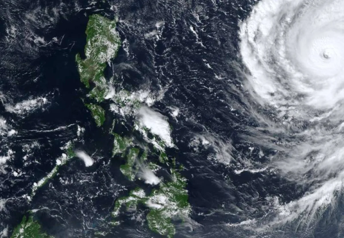
· 2. Stock photo · Satellite image of a typhoon over the sea east of the Philippines — The Manila Times